05°06′N 001°14′W
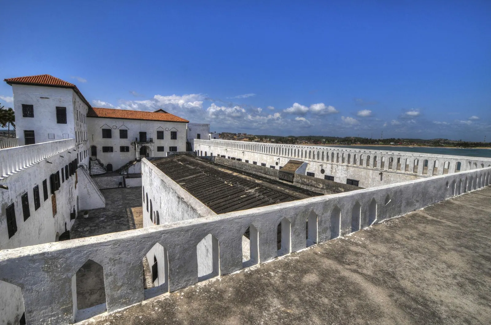
Cape Coast Castle
A whitewashed fort on the Gulf of Guinea and one of the most significant sites of the transatlantic slave trade.

Destinations
Filter by theme. Ghana is fully populated; the other guides fill as content is compiled.
A whitewashed fort on the Gulf of Guinea and one of the most significant sites of the transatlantic slave trade.
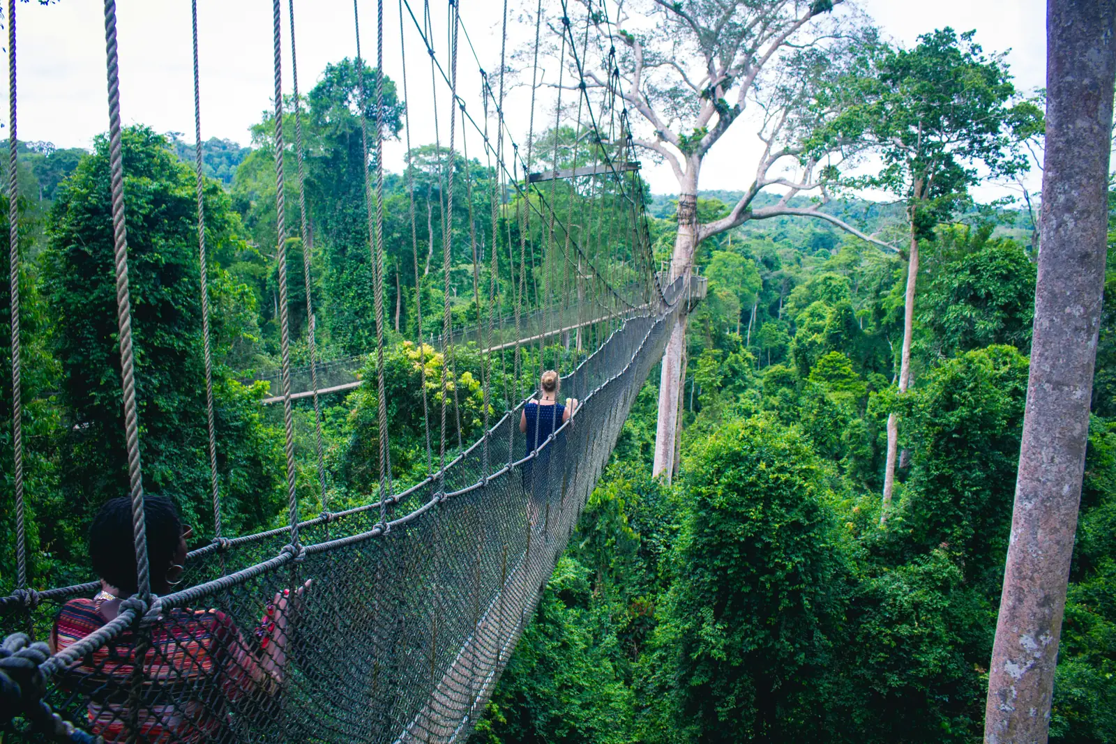
Tropical rainforest crossed by a canopy walkway suspended around 40 metres above the forest floor.
Ghana's largest wildlife refuge, where elephants gather at waterholes below an escarpment camp.
The oldest European building in sub-Saharan Africa, on a rocky Atlantic promontory.
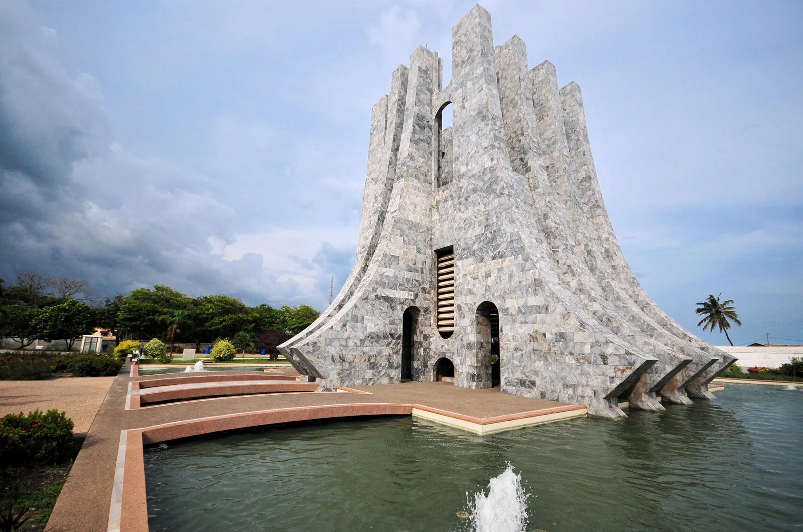
The park in central Accra where Ghana’s independence was declared in 1957.
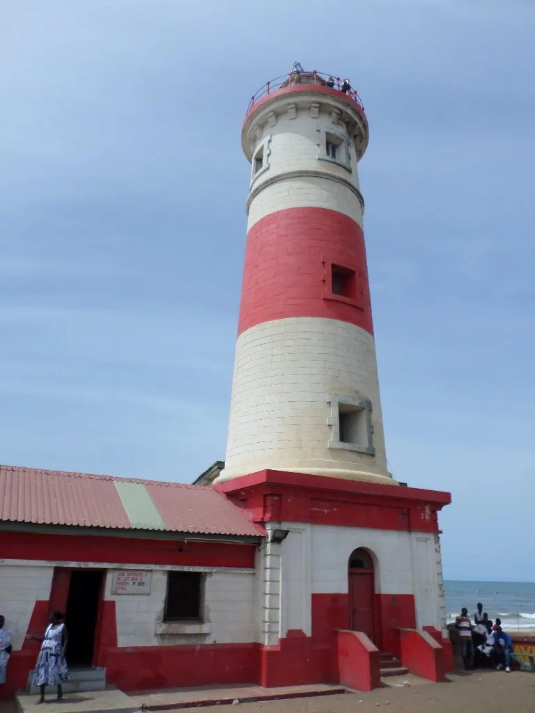
The old fishing quarter of Ga Mashie below a colonial-era lighthouse.
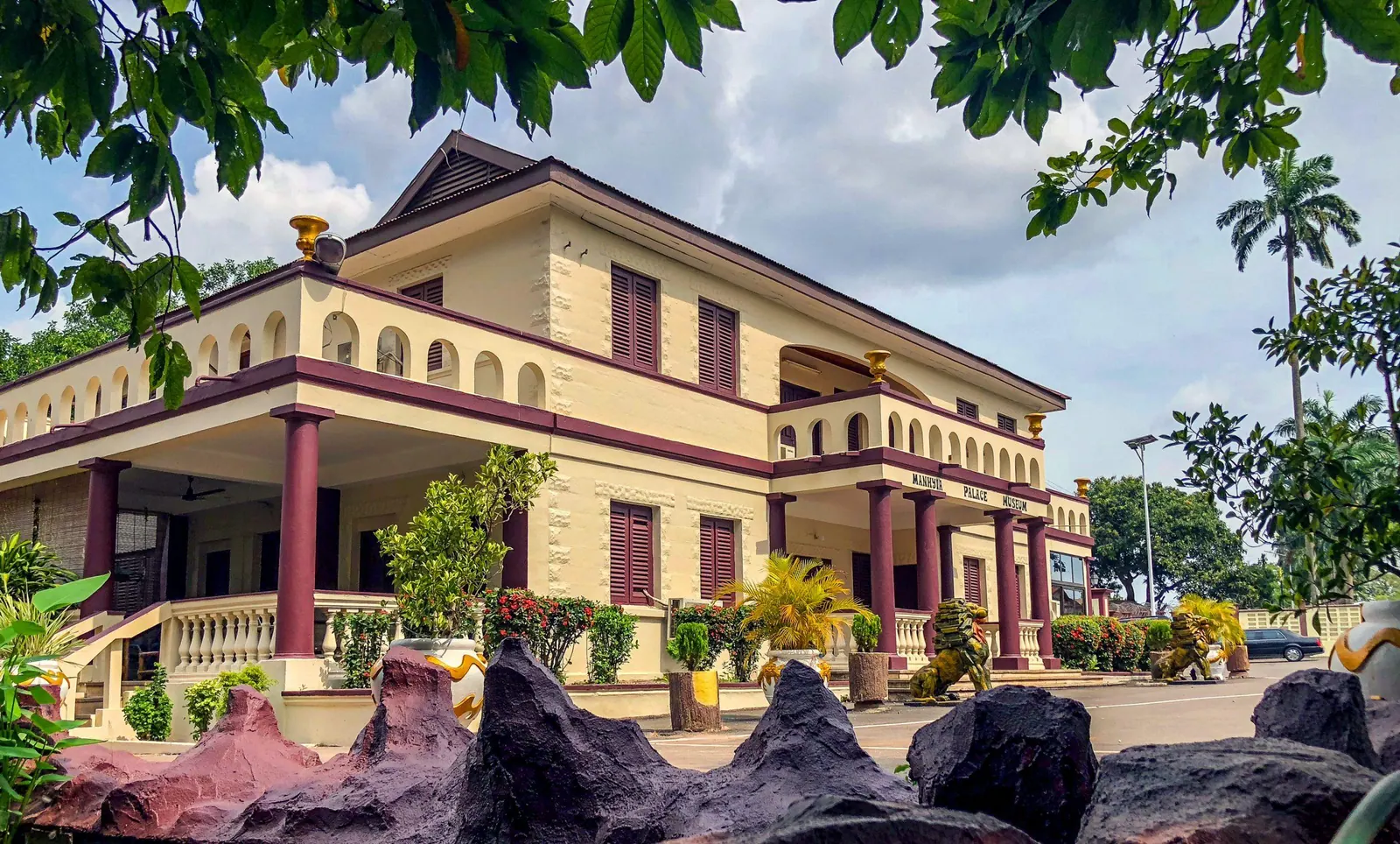
The former royal residence of the Asante kings in Kumasi, now a museum.
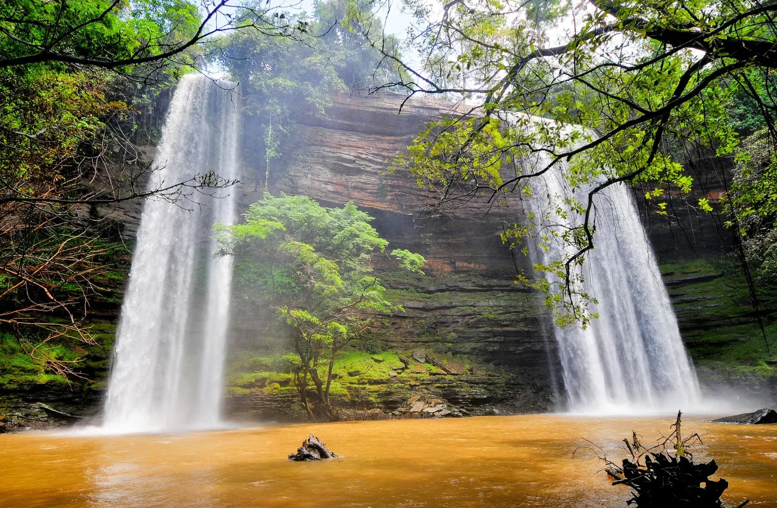
Twin waterfalls in a forest reserve, joined by a seasonal pool.
Hill-station gardens above Accra, laid out in 1890.
The highest waterfall in Ghana, in the Agumatsa reserve.
The dam that created the world’s largest reservoir by surface area.
The earthen palace complex of the former Kingdom of Dahomey in the city of Abomey.
A historic coastal town that was one of West Africa's largest Atlantic slave-trade ports and a centre of the Vodun religion.
A large stilt village built over Lake Nokoué whose houses stand on wooden piles above the water.
Benin's official capital, a Yoruba-founded city known for its royal palace museum, Afro-Brazilian mosque and ethnographic collections.
Benin's largest city and economic capital, home to the vast Dantokpa market and the Fondation Zinsou art institution.
A quiet beach town on Benin's southwest coast where a branch of the Mono River meets the Gulf of Guinea.
A large savanna wildlife park in northwestern Benin holding some of West Africa's last major populations of big game.
A multi-tiered waterfall in the Atacora mountains near the edge of Pendjari National Park.
The Atacora homeland of the Batammariba (Somba) people, known for their fortified two-storey earthen tata houses.
A cultural landscape of mud tower-houses built by the Batammariba (Tammari) people in north-eastern Togo.
Togo's capital and largest city, on the Atlantic coast in the Maritime Region.
A historic town on the northern shore of Lake Togo and an important centre of West African Vodun.
A former colonial capital on the coast between the Atlantic Ocean and Lake Togo, about 45 km east of Lomé.
A hill town in the Plateaux Region set among coffee and cocoa country, surrounded by forested slopes and waterfalls.
The highest mountain in Togo, rising in the Plateaux Region south-east of Kpalimé near the Ghanaian border.
The largest national park in Togo, a semi-mountainous protected area in the centre of the country.
Togo's second-largest city and the centre of Tem (Kotokoli) culture in the Centrale Region.
The main city of northern Togo and the homeland of the Kabye people, in the Kara Region.
A former French colonial capital on the coast east of Abidjan, inscribed on the UNESCO World Heritage List for its colonial architecture and town planning.
Côte d'Ivoire's largest city and economic capital, built around the Ébrié lagoon with the high-rise business district of Le Plateau at its core.
A coastal resort area on a sandy peninsula about 80 km east of Abidjan, popular for its beaches and lagoon.
One of the last major areas of primary tropical rainforest in West Africa, a UNESCO World Heritage Site in the country's southwest.
A vast Catholic basilica in the political capital Yamoussoukro, recognised by Guinness World Records as the largest church in the world.
The largest protected area in West Africa, a UNESCO World Heritage Site and biosphere reserve in the northeast.
A transboundary mountain reserve on the Guinea–Côte d'Ivoire border, inscribed as a UNESCO World Heritage Site for its endemic biodiversity.
A highland town in western Côte d'Ivoire ringed by forested peaks, waterfalls and rocky outcrops.
The main town of northern Côte d'Ivoire and a centre of Senufo culture, weaving and wood-carving.